Rare Book
Tuesday, 23 April - Thursday, 9 May 2024
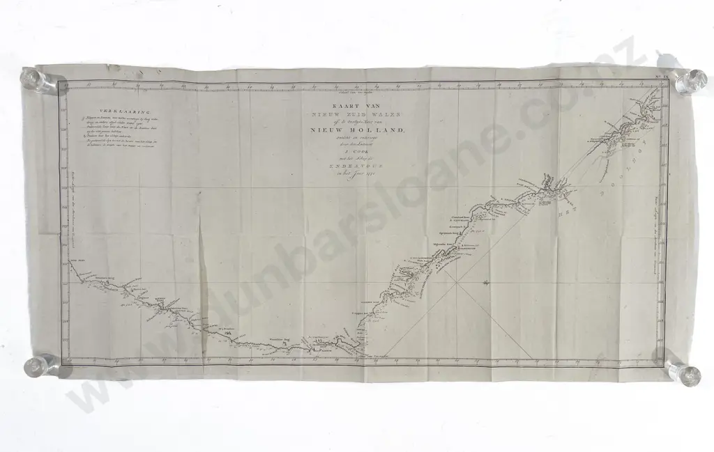
James Cook - Kaart Van Nieuw Zuid Wales of de Oostlijke Kust Van Nieuw Holland 1770
Estimate $300 - $500
Realised: $230 plus premium
Lot Details
A map of New South Wales or the East Coast of New Holland, discovered and researched by Lieutenant J Cook, with the ship Endeavour in the year 1770. Uncoloured copper engraving by Cornelis van Baarsel, published around 1797, this being the Dutch edition of James Cooks first map of New South Wales. Unframed, 39 x 82cm, fold marks otherwise a nice clean copy.